Geographic information system (GIS) is a computer-based system for capturing, saving, manipulating, and displaying data related to positions on the Earth’s surface. Geography is the main keyword.
Every land in GIS has some tabular data which is known as attribute data. Attribute data can be generally defined as additional information about each of the spatial features. An example of this would be a Hospital. Additional data means the hospital name, which type of hospital, no. of bed capacity etc. which would make up the attribute data. The system can include data about people, such as population, income, or education level. These applications may include cartographic data, photographic data, digital data, or data in spreadsheets.
History of GIS:
Tomlinson is acknowledged as the “father of GIS”, and in 1968, Roger Tomlinson used the term “Geographic Information System”. The early 1960s was a dark age of GIS, that time sieve mapping was used. The mid-1970s saw a new discipline being dominated by a few key individuals who were the ones to shape the direction of future research and development. The early 1980s saw the adoption of technologies by national agencies that led to a focus on the development of best practice. In 1986, Mapping Display and Analysis System (MIDAS), the first desktop GIS product was released for the DOS operating system. In 1990 MapInfo was renamed to Windows when it was ported to the Microsoft Windows platform. This began the process of moving GIS from the research department into the business environment.
GIS DATA MODELS: As we know GIS is based on a Data and there must be a data model. GIS is having two data Model.
- Spatial Data Models
- Attribute Data Models.
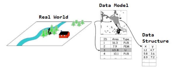
1. Spatial data are often referred to as coverages or layer. Spatial data is also known as geospatial data. From this data, we can identify the geographic location of features. It can be represented by numerical values in a geographic coordinate system.
There are mainly two types of representations used for spatial data.
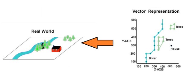
Vector: A vector data model uses sets of coordinates and associated attribute data to define discrete objects.A vector data have three basic types: points, lines, and polygons.
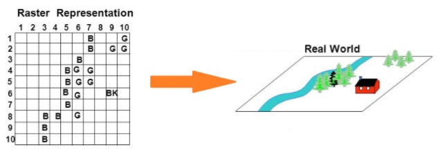
Raster: Raster data models define the world as a regular set of cells in a grid pattern.
2. Attribute data are used to record the non-spatial characteristics of an entity.Attributes are also called items or variables.Color, depth, weight, owner, component vegetation type are examples of variables that may be used as attributes.Different data models exist for the management of attribute data and storage data. The most common are:
Tabular Model: Tabular model stores attribute data as sequential data files with predefined formats. This type of data model is outdated in GIS arena.e.g. Limited indexing capability for attributes or records, etc.
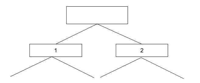
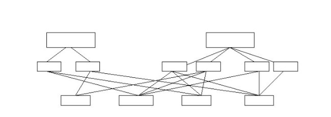
Hierarchical Model: The hierarchical database organizes data in a tree structure. Data is structured downward in a hierarchy of tables.Each pointer establishes a parent-child relationship where a parent can have more than one child but a child can only have one parent. There is no connection between the elements at the same level.
Network Model: The network database organizes data in a network. This model is conceived as a flexible way of representing objects and their relationships. Any column in a network structure can be linked to any other like a tree structure. A network structure can be described in terms of parents and children.
Advantages of GIS:
- Specific and detailed information is presented about one or more locations so that decisions are made easier.
- GIS offers a ԛuісk соllесtіоn of dаtа to be displayed on map.
- With the help of GIS, we can get geographic information to use it for human help.
- GIS technology can be used for scientific investigations, resource management, and development planning.
- GIS technology is used in different sectors like Police departments, Tourist departments, Government applications, Hotels. Real Estate, Health sectors etc.
- It helps to provide geographic problems solutions.
- GIS technology can also be integrated with the framework of an enterprise information system.
If you are looking to get updates or assessments for GIS, contact us today at +1-484-876-1867 or send us a message.